This auction is live!

You need to be registered and approved to bid at this auction.

Watch the auction
This auction is closed!

It is no longer possible to bid at this auction.

You are registered for this auction

You are now approved to bid at this auction.

Your auction registration is now pending

You have successfully registered for this auction, pending approval to bid. Please check your email for further information.

Your auction registration has been declined

Please contact the auctioneer for more information.

Two Day Book & Ephemera Auction to include Maps & Prints
Live
Venue address
Palmers Lane
Aylsham, Norwich
NR11 6JA
United Kingdom
Two Day Book & Ephemera Auction to include Maps & Prints

VAT is applicable on specified lots.

Auction dates
30 Aug 2018 10:00 BST
Lots: 1-798
31 Aug 2018 10:30 BST
Viewing dates
29 Aug 2018 09:00 - 18:30 BST
30 Aug 2018 09:00 - 17:00 BST
31 Aug 2018 09:00 - 10:30 BST
Auction currency
GBP
Accepted cards
We found 1174 items matching your search
Primary Category
Category
Brand
Item Type
Sale Section
Country
State/Province
Town/City
Sorted by
We have chosen not to publish our results. Please contact us directly for any enquiries.
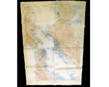
US GEOLOGICAL SURVEY: SAN FRANCISCO AND VICINITY, CALIFORNIA, large scale coloured map, 1915, backed
30 - 50 GBP
Estimate
SET OF TWELVE MANUSCRIPT PEN, INK AND WATERCOLOUR MAPS by the cartographer RENE MIOT (b1895), maps
30 - 40 GBP
Estimate
THOMAS DUGDALE: SURREY, engraved map circa 1848, approx 180 x 230mm + SAMUEL NEELE: NORFOLK,
30 - 40 GBP
Estimate
C SMITH: A NEW MAP OF THE COUNTY OF LEICESTER, engraved hand coloured map, 1818, approx 435 x 490mm
30 - 40 GBP
Estimate
JOHN CARY: A MAP OF HARTFORDSHIRE [HERTFORDSHIRE] FROM THE BEST AUTHORITIES, engraved hand
30 - 40 GBP
Estimate
J D'ANVILLE: 2 hand coloured engraved maps, published R Laurie, 1821, GERMANY, FRANCE, ITALY, SPAIN,
30 - 40 GBP
Estimate
Packet: five Suffolk hand coloured engraved maps comprising PIGOT, [1840], approx size 220 x
30 - 40 GBP
Estimate
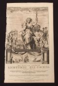
C J VOOGHT: DE NIEUWE GROOTE LICHTENDE ZEE-FACKEL..., engraved title page for atlas, 1687, printed
30 - 40 GBP
Estimate
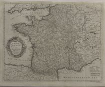
EMANUEL BOWEN: A NEW AND ACCURATE MAP OF FRANCE WITH ITS ACQUISITIONS COMPOSED FROM THE LATEST
30 - 50 GBP
Estimate
GALLIAE REGNUM IN OMNIS SUAS PROVINCIAS ACCURATE DIVISUM, engraved hand coloured map circa 1700
40 - 60 GBP
Estimate
J JANSSON: COMITATIS CANTABRIGIENSIS VERNACULE CAMBRIDGESHIRE, engraved map circa 1650, approx 400 x
60 - 80 GBP
Estimate
NICHOLAS SANSON: ANCIENS ROYAUMES DE KENT, D'ESSEX, ET DE SUSSEX ON SONT AUJOURDHUI LES COMPTES DE
40 - 60 GBP
Estimate
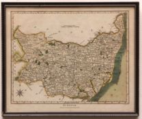
JOHN CARY: SUFFOLK, engraved part hand coloured map, 1805, approx 390 x 500mm
30 - 40 GBP
Estimate
CHRISTOPHER SAXTON/WILLIAM KIP: SUFFOLCIE COMITATUS..., engraved hand coloured map circa 1610,
120 - 150 GBP
Estimate
ROBERT MORDEN: 4 engraved maps, Buckinghamshire, Bedfordshire, Gloucestershire, Northumberland,
50 - 60 GBP
Estimate
ROBERT MORDEN: LEICESTERSHIRE, engraved map [1695], approx 355 x 420mm
30 - 40 GBP
Estimate
J HARRISON (PUBLISHED): A NEW AND CORRECT MAP OF LEICESTER AND RUTLAND ENGRAVED FROM AN ACTUAL
30 - 40 GBP
Estimate
RICHARD BLOME: A MAPP OF THE COUNTY OF NORTHAMPTON WITH ITS HUNDREDS, engraved map circa 1673,
60 - 80 GBP
Estimate
CHRISTOPHER SAXTON/WILLIAM KIP: HUNTINGDON COMITATUS..., engraved hand coloured map [1607], approx
40 - 50 GBP
Estimate
ROBERT MORDEN: NORTHAMPTONSHIRE, engraved map, [1695], approx 355 x 410mm
40 - 50 GBP
Estimate
JOHN SPEED: LEICESTER..., engraved map [1611], approx 375 x 500mm, some faults
60 - 80 GBP
Estimate
R MORDEN: LINCOLNSHIRE, engraved hand coloured map, circa 1738, approx 360 x 420mm
30 - 40 GBP
Estimate
JOANNES BLAEU: LEICESTRENSIS COMITATUS, engraved hand coloured map, circa 1662, approx 370 x
150 - 200 GBP
Estimate
ROBERT MORDEN: LEICESTERSHIRE, engraved map [1695], approx 360 x 415mm + CHARLES SMITH: A NEW MAP OF
50 - 60 GBP
Estimate
JOANNES BLAEU: LEICESTRENSIS COMITATUS, engraved hand coloured map, circa 1662, approx 380 x
100 - 120 GBP
Estimate
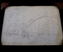
A HUGE LARGE-SCALE LATE VICTORIAN ORDNANCE SURVEY MAP - STRATTON STRAWLESS AREA, varnished, faults
30 - 40 GBP
Estimate
BOX: good quantity, mainly WWII period Ordnance Survey maps
30 - 40 GBP
Estimate
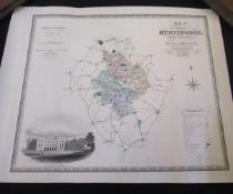
CHRISTOPHER AND JOHN GREENWOOD: MAP OF THE COUNTY OF HUNTINGDON FROM AN ACTUAL SURVEY, engraved hand
30 - 40 GBP
Estimate
AFTER JOHN WARD: WORCESTER COLLEGE FROM THE GARDENS, coloured print for the Oxford Almanack 1974,
30 - 40 GBP
Estimate