This auction is live!
You need to be registered and approved to bid at this auction.
Watch the auction
|
Auction currency
|
GBP |
|
Accepted cards for registration
|
|
|
Accepted cards for payment
|
Confirming your bid is a legally binding obligation to purchase and pay for the lot should your bid be successful.
Confirming your bid is a legally binding obligation to purchase and pay for the lot should your bid be successful.
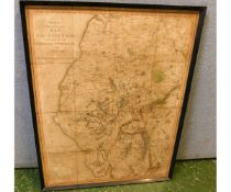
![EDWARD STANFORD: CEYLON, coloured map [circa 1890], approx 750 x 565mm](https://portal-images.azureedge.net/auctions-2020/srkey10319/images/556d91a0-f972-4f0b-bd14-ab5900d95807.jpg?h=175)
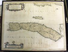
![EDWARD STANFORD: BURMA, coloured map [circa 1890], approx 550 x 495mm](https://portal-images.azureedge.net/auctions-2020/srkey10319/images/aecebed8-fcc3-4781-a334-ab5900d95b8b.jpg?h=175)
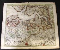
![EDWARD WELLER: ATLAS OF THE BRITISH ISLES, London, Cassell, Petter & Galpin [circa 1860s], 48pp of](https://portal-images.azureedge.net/auctions-2020/srkey10319/images/b9d88240-da32-42a9-89dc-ab5900d9649d.jpg?h=175)
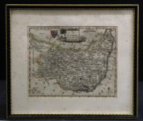
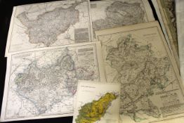
![ROBERT MORDEN: DORSETSHIRE, hand coloured engraved map, [1753], framed and glazed, approx size 440 x](https://portal-images.azureedge.net/auctions-2020/srkey10319/images/e557f049-be1f-43ea-ad49-ab5900e144c1.jpg?h=175)