This auction is live!
You need to be registered and approved to bid at this auction.
Watch the auction
|
Auction currency
|
GBP |
|
Accepted cards for registration
|
|
|
Accepted cards for payment
|
Confirming your bid is a legally binding obligation to purchase and pay for the lot should your bid be successful.
Confirming your bid is a legally binding obligation to purchase and pay for the lot should your bid be successful.

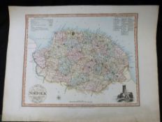
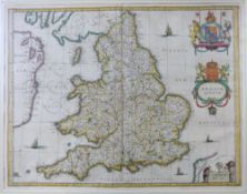
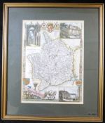
![ROBERT MORDEN: NORFOLK, engraved map [1695], approx 370 x 580mm](https://portal-images.azureedge.net/auctions-2021/srkey10466/images/c17dac97-3577-4c99-80b7-ace800bfecef.jpg?h=175)
![ROBERT MORDEN: MIDLESEX, engraved hand coloured map [1695], approx 360 x 420mm, framed and glazed](https://portal-images.azureedge.net/auctions-2021/srkey10466/images/f9564cd1-0bc9-4ff7-abdb-ace800bff54e.jpg?h=175)
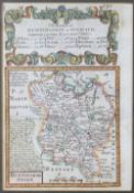
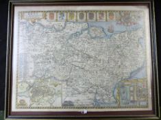
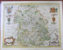
![ROBERT MORDEN: STAFFORDSHIRE, engraved hand coloured map [1695], approx 430 x 365mm, framed and](https://portal-images.azureedge.net/auctions-2021/srkey10466/images/36f72a3e-d226-43d5-adbd-ace800bff610.jpg?h=175)
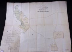
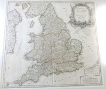
![ROBERT MORDEN: 2 engraved hand coloured maps comprising HUNTINGTONSHIRE, [1695], approx 360 x 420mm,](https://portal-images.azureedge.net/auctions-2021/srkey10466/images/72d2d1c1-e4cb-4e36-af1c-ace800bff6c9.jpg?h=175)
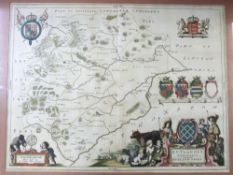
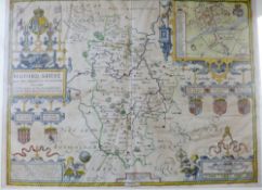
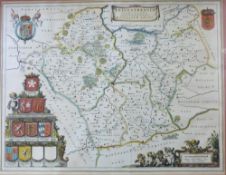
![JOHN SPEED: HEREFORDSHIRE..., engraved hand coloured map [1611], approx 375 x 505mm, double glazed +](https://portal-images.azureedge.net/auctions-2021/srkey10466/images/a8f42395-886d-472e-a8f1-ace800bff882.jpg?h=175)
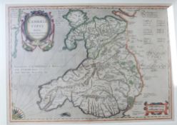
![JOHN SPEED: DENBIGHSHIRE, engraved hand coloured map [1611], approx 380 x 510mm, framed and glazed](https://portal-images.azureedge.net/auctions-2021/srkey10466/images/5c6a1b02-9de8-4a73-bcae-ace800bffac3.jpg?h=175)
![ROBERT MORDEN: HAMPSHIRE, engraved hand coloured map [1695], approx 360 x 420mm, framed and glazed](https://portal-images.azureedge.net/auctions-2021/srkey10466/images/7f34719e-1972-42ce-8135-ace800bffb6d.jpg?h=175)
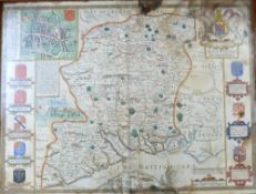
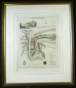
![JOHN SPEED: THE COUNTIE AND CITIE OF LYNCOLNE DESCRIBED..., engraved hand coloured map [1611],](https://portal-images.azureedge.net/auctions-2021/srkey10466/images/f6e288e1-8e7f-4751-9e13-ace800bffeb2.jpg?h=175)